Wednesday, October 5, 2016

The last half of the U.S.

Even though New York City was pretty close to the mid-point of my trip, my attitude took a sharp turn after that. I was no longer going INTO our dream trip, we were closing it out. Other than a brief clip of a crop duster (they've always fascinated me) my next video was to record my excitement of seeing the mountains on the horizon again. In this case it wasn't a matter of being nearer home, but a matter of being near Glacier National Park.

These water-efficient faucets are incredible. Who needs all that water splashing in your face? No problems with this one!

Once we were inside Glacier we came to McDonald Lake on the west end of the park. The lake was pretty and obviously an attraction for many, but my attention was on the backdrop.

When we arrived at Logan Pass, the high spot on the Going to the Sun Road, we spotted some Big Horn Sheep a short distance away. Unfortunately, I don't have a zoom lens on my phone.
(Editors note : I just went back and looked at this video, it's terrible! You'll have to believe me that there is a couple of Big Horn Sheep in there!)

The Garden Wall rises above the Going to the Sun Road and provides one of the most iconic sights in the park.
Just to the east of Logan Pass was this water fall. It is unique because it falls horizontally!:


After leaving Glacier I found a place that had a course consisting of 8 zip line rides through the tree tops. I managed to get a couple of video clips. Unfortunately, you'll have to turn your computer on it's side to see them:

Then there was Diablo Canyon in the North Cascade Mountains of central Washington. The glacial run off gives the water an incredible green hue.

A little further to the north (actually north of the border) was Shannon Falls, outside Vancouver, British Columbia.

As I neared the end of the road (literally, I was at the western-most point in the lower 48 accessible by road) I discovered Cape Flattery, an impressive shoreline on the Olympic Peninsula in Washington.
This panorama starts with the Kessiso Rocks at the western apex of the Continental U.S., then pans past Tatoosh Island, a U.S. Coast Guard lighthouse site, then pans to Vancouver Island across the Strait of Juan de Fuco.
And that's it. Not much exciting video (I may have to return to get better video, maybe make a documentary) but lots of memories ad a few good stories! I hope someone enjoyed the trip as much as we did.


More video from the south and East Coast

Maybe a panorama inside Cowboy Stadium will make it easier to envision the size and scope of "Jerry World". If only the field wasn't such a goofy color!

This is a twice daily parade in Fort Worth, Texas. It began as the way the Long Horns were brought to market but they now use a lineup of Rock Stars that spend their days in the Green Room, waiting for show time.

This is our recreation of the view along the route of the presidential motorcade on November 22, 1963 (we let most of the extras go home)

and the view from the Grassy Knoll

back to the coast again, I stopped at the Johnson Space Center Visitors Museum

then moved on to the Galveston to Bolivar Peninsula Ferry crossing


So, finally, some action video! I must confess I was more than a little concerned about flipping the boat due to the childhood trauma that occurred at Lake of the Woods Minnesota/Canada...

and this, of course, is why we were out there in the first place

This is a bit better action shot. Near the beginning of the clip you can see the front corner of the boat dip and scoop up water as it stops. Makes me nervous just watching it. I'd prefer something a little safer like a zip line, or at least some whiter water (this was very brackish water).

I guess I did not think to take video of the Scrub Jays we visited in Florida, but a little further north I was thinking in terms of action again


The tour of the Super Speedway at Daytona was incredible for this old race fan.

In this clip please note a couple of things. We were riding on the apron of the track meaning we were flat on the ground and OFF of the racing surface. So the small strip of track you see between our position and the outer guardrail is all the room there is for the often-three-wide racing that takes place on this track surface! The 33 degree banking, which even in this clip doesn't really show how steep it is, can be appreciated by this fact - the pace car that comes out on the track to slow the cars down during caution periods, has to go 70 mph to keep up on the banking.

I didn't get any video while my brother and I were racing Go-Karts in D.C. because I couldn't figure out how to aim the camera behind me...
but did shoot video again while sailing in New York Harbor on a Tall Ship

As I mentioned in the blog, I was allowed to help the crew hoist the jib. Obviously while doing that I could not get video footage, but I did get a picture of the rear main sail being raised, as well as a picture once we were sailing under "full sheets".

My only other video in New York was shot during take-off in my first-ever helicopter ride.


let's see what else we have

A couple of clips from Tombstone, one from behind Clem...

and one from inside the OK Corral (you thought there's too much violence in the streets TODAY?)

and for the younger generation - There's an app for that!

I was hoping I had some amazing panorama of the beauty that was everywhere in the amazing southwestern desert (that's my sarcastic font) but it looks like I have this shot of the Mexican Border alongside International St. in Douglas, Arizona...

and, if that's not enough action for you...

One of the things that always surprised me when hiking in the desert was how it was so flat and dry and... well, more flat and more dry, then, seemingly out of nowhere a cavernous, uh, cavern, appears. You know at one time there was a lot of water here. Was it spring run-off from distant mountains or left over scars from the age of water which came just before they invented Global Warming? Take a look at this picture of Eagles Nest in Southwest Texas:


I believe I blogged about this at the time. This was taken on the University of Texas, Brownsville campus. They have classes (I do not know if it is a program offering a degree) to train border guards, complete with a working classroom border crossing. On the other side of this fence is a walkway from Mexico. I asked if it was open during class hours for actual immigration but no one spoke English.

This is rush hour in Corpus Christi, Texas...

and the coast as it appears in Galvaston

Tuesday, October 4, 2016

I'm on a roll now

purring like a kitten - a WWII kitten!

Here are a couple of videos from Lego Land...

my Grandkids couldn't wait to get wet!
This was a learning experience. I thought that the picture would turn during record as it does during viewing. Instead Ashley ended up shivering sideways! OOPS!


more videos


Well, I seem to be doing well. Now if my videos were only eye popping instead of tear producing!

Let's check my bag of gag again.

After leaving San Fran I found these Elephant Seals on the beach and surfing just off shore near San Simeon

so let's see what else we have...

I thought Port Orford was one of the prettiest and most unique towns on the Oregon Coast. Because of it's openness it offers no shelter to water craft during storms. So all boats anchored within must be lifted out of the water and set ashore. To the south is Humbug Peak, the highest point on the Pacific Coast of Oregon.

A few short miles south of Humbug Peak the highway comes out to a strip of open beach, allowing a view of sand and waves nearly as far as the eye can see. Driftwood on the sandy landscape gives it a feeling of isolation even though you are a mere 12 miles south of Port Orford.


On day 7 we boarded a ferry to Alcatraz

Day 8 featured a ride on the fabled cabled car, which utilizes a roundhouse to change directions at the end of it's route. The roundhouse is operated manually! I have video of the car negotiating a steep San Fransisco hill, but my I.T. department will have to help get it up and running.

Sunday, October 2, 2016

If at first you succeed...

Hey, that worked! (at least on my computer). I'm told by the San Diego office of my I.T. team that the video may not work on all computers (I know it doesn't work on my I-Pad). But if these videos work for you, let me know.

Here is another view of Devils Churn:


Ok, if this works we'll try multiple videos

Post Mortem?

Because I have concluded the wonder that was P48, my blog entries have long since ceased, I thought I'd sit here in front of my computer and see if I could figure out how to add some of the video footage I filmed. I also have put together a Power Point presentation to display more of my pictures, if anyone is interested.
So here goes...
The first entries are video of the Devils Churn along the Oregon Coast

Tuesday, August 16, 2016

Day 94 - Fini

a dash through the heat of Eastern Oregon

All I had to do was ride...

and ride, and ride. In theory it sounded quite simple. But anyone who has driven from Sisters to Boise knows it is a long journey through high desert. When I passed this way in April it was a little chilly. Today was predicted to be hot with a high of 97 threatening any thoughts of a late start. I was, however, not in a hurry. I figured to make numerous stops to break up the day.
I had hardly gotten started when I came into Bend, a stones throw from Sisters. Simultaneously, my Tripometer approached a milestone
I had originally mapped out my route at a distance of 16,200 miles. Some adaptation was done to include sights and locations as I learned of them. Unfortunately, while watching the meter go round and round, I somehow missed a turn onto highway 20 in Bend. After taking the picture I travelled several miles before realizing I was on the  wrong highway.
I wasn't going to make The Girls work today but they jumped in and got me back onto highway 20. It was a 130 mile grind to get to Burns and that wasn't the half of it, literally. There just aren't a lot of places to take a break. The long distances between stops were made even harder, twice, by long delays for construction work. Sitting in the sun in a helmet and leather jacket isn't the type of excitement that motivates you to keep going. By the time I reached Vale, Oregon I was thinking of getting a motel for the night. It was a 300+ mile day, why push it? So I stopped at the first motel I came to
I don't know if you can read the sign or not, but it was the Bates Motel, not a name to instill confidence in the quality of their Wi-Fi.
So I stopped for dinner, then pushed on. 
I had to stop and get the final "Welcome to" sign when I entered my 33rd different state (I hadn't counted Idaho before because I had not crossed into it as a new state).

I arrived in my driveway at
The final mileage was
17,320.1 miles 
Total of 94 days on the trip itself, 113 days all together with lay overs, a greeting on the door from a dear Scouting friend
So:
1) shoe ruined
Gear shift lever put a hole in the toe of my new shoe

1.50) cost of a shot of whiskey at the Ghost Hole

2) back tires worn out
Replaced the first one in New Jersey

3) oil changes (Dallas, New Jersey and Wisconsin)

4) time zones coast to coast

4.54069) Litres in an Imperial Gallon

5) times riding in major rain (defined as being soaked through my rain gear and requiring emptying my shoes)

6) something - I'm terrible at this – times I rentered a state from a different direction

6.95) cost of most expensive gallon of gas I purchased (near Big Sur, Ca.)

7.91) total Florida toll bill received, along with a nifty souvenir picture


8) times I crossed into a different time zone

9) Mbs average data rate of motel Wi-Fi (if I had a good connection)

12) Times I was rained on hard enough to be considered wet (defined asmore thanjust the vertical portion of my lower leg was wet)

13) residences of friends/relatives that supplied lodging for a wandering Frog (that includes Dave!)

23.83) miles across Lake Pontchartrain bridge

30) forms of transportation utilized

32) different states ridden in (plus one province, British Columbia) and the District of Columbia)

90) folders of pictures saved

94) days on the road

113) days total for trip

127) viewers who read this blog

201) posts

223) cost of most expensive night at a motel (again, at Big Sur, Ca.)

310) comments (thank you for your feedback, I loved reading them)

1000) feet, the approximate distance I was from the 5th time zone (Atlantic Time Zone, half way across the bridge next to the Lubec, Me. Post Office)

1875) estimated number of pictures taken

2520) actual number of pictures saved from trip

6646) highest elevation attained by road (in feet)

7,980) page views from 4 countries! and no spam!

17,320) total miles covered on trip

priceless) Cost of traveling around the perimeter of the U.S. with your best friend

Now I need to get my life back together and figure out where to go from here. I look forward to spending hours labeling and sorting pictures, sharing them and the stories behind them with many of you.
This was not just an adventure but an emotional journey that I hope will help me move forward and find purpose and drive in my life. I thank everyone for their love and support in making this possible and hope all of you will make a point of letting me know if you have followed these posts.
The Beginning


Monday, August 15, 2016

Transportation collection

The question was asked "how many modes of transportation have you used?", or words to that affect. I don't know if I can list them all but maybe someone can fill in if I forget one (or two, or three).
1) motorcycle 
2) walking (Golden Gate Bridge, etc)
3) bus (San Fran public transport)
4) subway (San Fran public transport)
5) cable car (San Fran)
6) street car (San Fran)
7) WWII Bi-plane ( So. Cal)
8) stage coach (Tombstone, Az)
9) pick-up (Lisa's)
10) long horn steer (Ft. Worth street fair)
11) air boat (alligator farm in Alabama)
12) horse drawn carriage (Savannah, Ga.)
13) golf cart (Pinehurst G.C.)
14) elevator (Sea Lion Caves, etc)
15) small channel ferry (Corpus Christi, etc.)
16) large transport ferry (Cape May ferry)
17) passenger ferry (Staten Island ferry)
18) helicopter (Hudson River tour)
19) tall ship (New York harbor)
20) aluminum fishing boat (fishing in Wis)
21) SUV (Jeep rental in Beloit)
22) Polaris ATV (buffalo jump excavation site, Wy)
23) Gondola (Sea to Sky north of Vancouver, B.C.)
24) bicycle (Dave's back yard)
25) commuter train (San Fran and N.J.)
26) Ziplines 
27) taxi (in New Jersey)
28) Go-Kart (in Washington D.C.)
29) sight-seeing tram (at Daytona Speedway)

I also found, but did not use:
Steam locomotive
Tank
Hover board
Railroad maintenance pick-up that runs on tracks
Cargo wagon
Water taxi
Pontoon plane
Buggy
Surrey
Tandem bike
Railroad track bicycle
Paddle boat catamaran 
Lunar landing simulator
Space Shuttle
Space Shuttle transporter

Any idea what I'm missing? There are numerous car styles/models and too many planes to count all the styles/models

Day 93 - Waldport to Sisters, Or.

Lots of mountain dancing

Dessert anyone?

Almost exactly a year ago I sat in Takoda's restaurant in Sisters, Oregon with my good friends Scott and Bev, Tom & Sherie, and new friends Brian and Dean (two of Bev's many brothers) and Mike. We had just completed a 35 (approximate) mile section of the Pacific Crest Trail and we're celebrating over a good meal and lively discussion.
Tonight I was back in Takoda's celebrating again, this time internally cheering the completion of P48. I know Betty would have planned a party but I'm not that organized! So I ordered the chicken.
Having finished the actual perimeter yesterday I was ready to head home today. The shortest route home just didn't seem appropriate so I had decided on the scenic route. Scott had told me about the McKenzie Highway and said it would be a great ride. So I picked a route up and over the Siuslaw National Forest for a great ride from the coast to Corvalis.
The last thing I thought I would be dealing with in mid-August was cold weather, but the last two days have been chilly with the sun struggling to burn off the coastal fog. This morning was the same situation, low hanging fog along the coast holding temperatures down. Yesterday, as I pulled into Waldport, the time/temperature clock told me it was 60 degrees at 4 p.m.
This morning I would guess the temperature was in the high 40's when I started climbing inland. I was 15 miles along before I had climbed high enough to break out of the fog. By that time I was fully involved in mountain dancing my way east through an endless series of 20 to 45 mph curves under dense tree cover. It was delightful.
I stopped in Philomath, just west of Corvallis, to get gas. Somehow the fact that the station sat between two one way streets escaped my notice. There were no signs posted to indicate that the one exit was east bound only, the other west bound only. Thinking I would circle around the block to get back on track I headed east on west bound Highway 20.
I'm not sure if it was the pick-up that honked when I went past, the fact that the lines on the road were all white (no yellow down the middle) or the semi that was coming directly at me but I figured I was out of position somehow! "Do a U-Turn" was my mantra, even though The Girls didn't say a word. You'd think they'd scream or something!
From Corvallis I went south on 99W South, even though The Girls found their voice and tried to put me on the parallel route of I-5. It was virtually flat and straight, a real anti-pasta before dessert.
The dessert started on Highway 126 east of Eugene, as it headed up the McKenzie River on its way to McKenzie Bridge. The route was pretty but not what I had expected based on Scott's enthusiasm.
It wasn't until I stopped to take a break at McKenzie Bridge that I recalled another word that Scott used to describe the route - "old". 
I was on the McKenzie Highway and Scott had recommended the "Old" McKenzie Highway. About a mile up the road I found the Ranger's Station which straightened me out. In just two miles I would find highway 242 on the right - the Old McKenzie Highway that would wind and climb up and over McKenzie Pass on a nice road that narrowed as it counted off 2,000, 3,000, 4,000 then 5,000 feet of elevation. Each landmark came complete with uncounted hairpin turns. 
I saw Betty's protecting hand on my climb. I wasn't "pushing it" in the turns but was enjoying accelerating on the exits when a car pulled off of a side road as I approached. This slowed my forward progress as I hung back and followed the car through the next several turns. It was two of those turns that offered up the only mid-turn gravel that I would encounter on the 36 or more miles to Sisters and she was making sure I was going slow enough to not have problems. It could have been a coincidence, but I don't think so.
As I approached the top of the pass the terrain suddenly and unexpectedly turned to a lava bed at Belknap Crater.

A short distance later I came to the Dee Wright Observatory. A long time Forest Service employee in the area, he was honored by the naming of a unique Observatory built at the summit. A walkway circled around and up into a pile of lava rock shaped like a fortress. The windows in the walls aimed your line of sight at a distant peak that was labeled under the window opening.
The fortress was an ideal spot from which to view two of three Sisters

as well as Mt. Washington and Mt. Jefferson. 
This was the "high point" of my day
From here I rode down the east face of the pass and into Sisters, where "no room at the inn" moved me from the Best Western, where I spent Day 1 back in April, to the Sisters Inn and Suite across the highway, right next door to Takoda's. Closing the circle as I close the year.


Sunday, August 14, 2016

an emotional end

After taking a very brief ride on Dave's bike I hit the road, headed south again, toward a point in the city of Waldport where highway 34 heads inland to cross over the Siuslaw National Forest. The highway will be my path to Eugene where I will catch the McKenzie highway back to Sisters, Or. 
But all of that will be anti-climactic when compared to what happened today
At 1:56 p.m. (My "clock" is still set to Mountain Day Light Time) I pulled up to this intersection
My Tripometer read thusly
At 16,754.0 miles my trip was completed when I returned to the intersection that was the beginning of P48!
I flagged down a passing-by man on the street who gladly took this picture
I sure look exuberant don't I? Despite the outward appearances, it was emotional for me. It doesn't seem possible that, in the last 115 days or so I have visited the southern-most, eastern-most, western-most and very nearly the northern-most point of those lower 48. Incredible panoramas, scenery that would take your breath away, rain and hale storms of historic proportions, mountains and deserts, forests and urban sprawl, high end neighborhoods and depressing poverty, unique artwork, patriotic displays, lakes, oceans, quagmires and bogs, and, of course, the different forms of transportation, perhaps best illustrated by this one I saw today
Each car is propelled by all occupants pedaling like a bicyclist

I talked to three cyclist today after finishing my quest. Two of them rode down from Alberta, beginning a loop that will go into California, Nevada, into Colorado and the Rocky Mountains, then home again. The other, Rudolpho, had just arrived from Mexico City and was headed to Vancouver. They all share the joy of the open road and an amazement of the scale of this country, not to mention a spirit of adventure. 
I look forward to having the opportunity to organize pictures, gather thoughts and re-write some blog posts. Maybe a book is in the future or maybe I'll make a movie. Who do you think should play the lead? Pee-Wee Herman or Matt Damon?


Day 92 - Rockaway Beach to Waldport, Or.

Day 91 - Clallam, WA. to Rockaway, Or. and beyond

A very long day

Where to begin, where to finish addendum

I was sitting in a booth in Denny's. I had, on numerous occasions, gone to a sports bar and spread a meal out over three plus hours so as to watch a Boise State football game (that would be on a blue field Tom!) but this went far beyond that skill set. It was 9 p.m. and I had ordered a cup of coffee. The waitress stopped by several times to see if I was ready to order. I finally told her of my dilemma. 
The way I saw it I could go to the police station and confess that I have an outstanding parking ticket in Rome (I'd hold the parking tickets that I have in Boston, Cleveland and Boise for my ace in the hole), hoping that they would put me in a cell overnight until they contacted Roman authorities to see if they wanted to extradite me for an $XXXVIII ticket.
The waitress, Madison I believe her name was, talked to her manager to see what and where she would recommend I turn for help. A gentleman on the other side of the restaurant over heard the discussion and said he knew of a campground in Garibaldi, 9 miles to the north. He started giving me directions and, apparently, noticed my eyes glazing over. He finally offered this: he was sleeping in a tent in his brother's yard and knew there to be sufficient room for another tent. 
"No sense paying $36.00 for a tent site. My brother won't mind. I'm heading that way right now if you want to follow me". 
We had both just received our checks from the waitress so I thanked him and paid for his dinner. When we got outside he added "I need to make two quick stops before I go home. I need to pick up a barbecue for my brother's birthday present - today's his birthday, then I was going to stop and play a quick game of pool. Do you play pool?"
"Not well enough to claim it as a skill".
Follow me, were his parting words. So we took off to the north, he driving like a local who knew every curve of the road, I riding hard enough to keep sight of his tail lights. Nine miles later we pulled into the parking lot of the Ghost Hole, a Kareokie bar with a pool table. Dave, as he introduced himself, needed to go next door "for a minute" so I went inside by myself, found an empty table near the pool table. I no sooner sat down than an attractive young lady came over, plunked her stuff down on the table and went over to the table. She appeared attractive but not overly so, and she was dancing around the table like she had already enjoyed her first of many drinks. Dave eventually showed up and jumped in to play against her. They talked and acted as if they had met before, but not as if they were friends. I went to the bar and uttered words I did not think I would ever utter, "give me a shot of whiskey" (it was for Dave).
After the first game Dave insisted that I play a game. As I got up and approached the table the young lady came over and asked "you smoke?" 
"No".
"You socialize" she added, using air quotes to convey a meaning for "socialize" that was outside my lexicon. 
"Sometimes". Not the answer she was looking for apparently because she handed me off to the guy she was with, whom I was now going to play a game of pool against while Dave and his lady snuck out the back door to "socialize", saying she was going to grab a "smoke".
His game was not much better than mine so the game took awhile. Being that we were in Oregon I assumed that "She" and Dave were sharing a joint. But they either had a huge doobie or were "socializing" in a different manner.
When, long after I lost the game, Dave returned ("she" had returned first, then after going through her purse, disappeared out the front door). Dave bought another shot of whiskey, then played another game of pool. "She" came back, then left again after dancing around the table a couple of times. "She" sure was sociable, and her guy didn't pay much attention to her coming and going. Just saying...
Finally Dave came up and said he was ready to go so we left. He was going to pick up the barbecue the next day so he was ready to head to his brother's place. He took off down the Highway toward Rockaway Beach and I now was riding through the fog, in the dark, down a twisty highway across the face of cliffs, unable to watch for deer as I tried to keep up with a set of tail lights fastened to the back end of a vehicle being operated by a guy who had just downed two shots of whiskey and possibly smoked a joint (or two?).
We ended up safely in his brother's driveway where I was introduced to the brother, his wife and someone named Ryan (I missed the relationship explanation). They lived in a house that was nearly a hundred years old, just a block off the highway, among an eclectic collection of items that would have amazed any antique or junk dealer. We set up tents but then Dave insisted on breaking out the guitar so he could play the chords he knew with a special guitar pick. 
It seems that he was one of 18 kids (his, hers and theirs) and, at the age of 6, was pushed on a bike by his brother, in an attempt to teach him how to ride, into the back end of a truck. He severely pinched the end of his right index finger and cut it off. His nail then eventually grew over the end of his shortened finger, leaving him with a permanent guitar pickin' finger nail.
So he sat outside after all the neighbor's lights were off and strummed his guitar. Eventually we turned in.
This morning I got a better look around the back yard and found this
At least I got a free camp ground and another form of transportation out of a very strange night.

Where to begin, where to finish...

When last we spoke (ok, I wrote, you read) I was faced with a dilemma, one that had not surfaced in the last 100 plus days. But before we go there, let's go back to Friday night. 
I was able to find a room at the Bay Motel in Clallam, Wa. (actually Sekiu) on the Olympic Peninsula, despite having been told by a General Store owner that there were no motels further north on the peninsula.
Saturday morning I continued on my way north to Neah Bay which, as it turned out, is on the Makah Tribal Reservation. With the sun shining freshly on the waters of the Strait of Juan De Fuca it was a beautiful ride.
Looking east toward Clallam Bay

It was approximately 20 miles to Neah Bay, and by the time I got there I was ready for breakfast. There is a large restaurant on the right as you enter this Indian fishing village so I stopped. While there the young lady filled me in on the road to Cape Flattery, the western most point in the lower 48 accessible by road (technically, the trailhead is accessible by road). Because it is "on the res" a recreation pass is needed. This restaurant, because it is on the res, will add the cost of the pass to your omelet!
It is a well marked, paved road to the beginning of a 1/2 to 3/4 mile trail.
I don't know if the surprise was because I had never heard anyone tell of the beauty of Cape Flattery, but surprised I was, in a huge way. This is not only the western most point but, upon seeing this landscape it jumped to the top five on my list of replies to the question "what has been your favorite place that you've seen?"

Looking north-east

Looking south-west

The Cove

Totoosh Island to the north-west, complete with lighthouse

After admiring for awhile I headed back to the parking lot. The peninsula is home to, not only the res (and a correctional facility), but also the Olympic National Park. The problem is that there is not a road that traverses the west side of the island and no road that crosses the park. So I back tracked on 112 until I hit 113, then crossed to Highway 101, the same Highway 101 that began my journey down the Pacific Coast back in April. That simple fact really drove home the idea that this trip is nearing its end.
I rode all the way off of the peninsula, looking to stop just short of Astoria, Oregon. Astoria is a vacation destination and therefore everything from food to motel/hotel room prices is higher priced. The problem ended up being that Astoria was the site of a large Regatta this weekend, making this the busiest weekend of their entire year.
My search continued from town to town, with each one supplying its full inventory of "no" signs on their "vacancy" signs. I found myself rolling into Astoria dreading the cost I would incur getting a room. If only it was that simple. 
There were no rooms, and there would be no rooms for many many miles. I rode south, along the Pacific Coast highway, all the way to Tillamook, making it a 390 mile day, one of the longest of my trip. I had tried to call ahead to see if I could locate an available room but no one was answering the phones. Then my phone battery went dead. I should have stopped and plugged it into my bike's battery charging system but I was racing other vehicles through each town, trying to locate a place for the evening. When even the motels in Tillamook proved fruitless I cashed in my chips. I had eaten hours earlier so a Denny's sign caught my attention.
It was chilly, foggy and dark. I was traveling on a twisty road that occasionally wound along the edge of a road high on rocky cliff sides. There were deer crossing signs everywhere. I didn't see where it was safe to explore gravel roads under these conditions for campground possibilities. Ordinarily I would just sleep in the car but...
That's about where we left it yesterday, but that was far from the end of yesterday.


Saturday, August 13, 2016

This should be interesting

I have been riding all day - well over 300 miles. I have been trying to find a motel/hotel/campsite since 4:30. It is now 9 p.m. There is no place to stay within a 70 mile radius, at least. My phone is dead. I'm sitting in a Denny's (they're open 24/7 Brian) for what may end up being the longest cup of coffee in history! I can't keep driving because it is dark and foggy, the road is twisting along the Pacific Coast and it isn't safe. After 100 + days on the road it has come down to this. What do I do? Rent a car so I can sleep in it?
This should be interesting!
Now I'm repeating myself. Have to do something to fill the time.

Friday, August 12, 2016

Day 90 - Vancouver, B.C. to Clallam Bay, WA.

A day at sea, or waiting to get there

Just like the Navy - hurry up and wait

The mileage was way down today, in spite of perfect weather. The reason? The water, or getting across it.
I left the motel about 9 this morning for a drive through downtown Vancouver. The city is pretty! No doubt about it. But, just like my drive along the coast yesterday, there were no places to pull over and enjoy or photograph the city. I grabbed this picture while sitting at a light

From the bottom of town I found my way to the B.C. ferry docks with very few U-Turns! It was 10'ish when I pulled up to the ticket booth. I had been told that motorcycles had head of the line privileges because they were loaded first.
Sure enough, I bought the (expensive) ticket and was instructed to ride, in the fire lane, past the building and all of the other vehicles, then jump in the head of lane #40. There were 3 or 4 other bikes there that I joined for the 11:00 ferry to Victoria, the Capitol city of B.C. on the island of Vancouver.
Aside: Did you know that the island of Vancouver has no source of fresh water, no lakes, no rivers. Victoria then is perhaps the only Capitol city in the world that has to import all of its fresh water!

Now that I typed that out, Google tells me it's not entirely true. They've had a long frustrating history with water sources and currently use a water retention and distribution system that holds enough water in reserve that the city could go for 2 years without rain before running out.

So I was sitting in line talking with the other bikers, specifically Tony and Tracy who live just east of Vancouver. The Ferry traffic director came along and told us to crank up the motorcycles, which we did. Because I was the last one in I was at the head of the line. The guy said the cycles should go up the ramp and pointed to the base of the ramp. So I headed over to the right where the ramp was. The sign above the ramp showed lanes A and B but gave no indication which one was to be used. I took the near lane (B) and went up. At the top of the ramp were red cones forcing lane B to go left, lane A to the right. Unfortunately I was first in line and had no basis from which to decide. Because I was in lane B I turned left and went across the top. Looking in my mirror I saw the others stop, then go straight up lane A. My lane turned right and climbed up to a boarding ramp, a ramp with no ship under it! So I did one of my well practiced U-Turns and circled back to lane A, where I followed the others onto the ferry and to the front. I explained that this was not the first U-Turn I had done. They all laughed knowingly.
After lining the bikes up we went upstairs for the 90 minute ride across the Salish Sea to Victoria. I had a nice visit with Tony (who moved to Canada 24 years ago from South Africa) and Tracy. When eventually we landed we disembarked, riding off of the boat and up the highway to the first exit, which was designated as the U-Turn route! We all did U-Turns and came back to the ticket booths, they to board a boat to another island where they had a motel reservation for tonight, me to get on a boat to Port Angeles on the Olympic peninsula of Washington. 
When I got to the booth they told me I needed to go to a different ferry dock smack dab in the middle of Victoria some 30 distance units away (I thought they were kilometers, but after fighting traffic into the city it seemed like miles). So, once again, I was instructed to do a U-Turn. We actually had landed at Swartz Bay, not Victoria.
Traffic was a mess, as I said. The road to Victoria was loaded with stop lights, each one affording the opportunity for traffic to back up.
Finding the dock I was looking for was a little challenging. Because I was outside the U.S. there were restrictions on data so I wasn't using my GPS. I got close, then flagged down a local couple for directions. They used their data to show me a map!
When I pulled in to the ticket booth I was once again directed to do a U-Turn and advance to a position at the head of the line. Because this trip would result in my return to U.S. soil I had to go through customs, this time without an inspection of my bike or answering questions about Betty.
It was about an hour wait in the sun but eventually we loaded into the front corner of the boat. Unlike any of the ferry rides I'd taken thus far, this time I was instructed to secure my bike with rope to the railing. They must have had an issue with a bike tipping over (maybe when they bumped a pier too hard?) and damaging someone's vehicle.
On the way out to sea I spotted several more modes of transportation that may necessitate a return trip.
Peddle pontoons?
Cutest water taxi ever!
They also had a plane on pontoons that looked like fun!
This trip I was talking to a rider from Calgary and another couple from Green Bay. Discussed a number of rides that may have to be considered.
By the time we arrived at Port Angeles my plan for the day had been flushed. Instead of circling the peninsula and heading back to the main land it now became a matter of figuring out if and where I could find a motel on the peninsula. The distance to the western most point of the contiguous 48 states accessible by road was over 60 distance units, and this time we're talking miles! I went quickly north on Highway 112 and stopped at a General Store to ask where accommodations might be found.
"Are there any motels north of here?" I asked.
The response was not good. "Not this far out". I was given the name of a cottage for rent and a nearby campground, both of which proved to be full.
The story now became a race with the sun. It was already going on 6 o'clock and I had about 50 miles of narrow winding road ahead of me. Could I make it to Cape Flattery before dark? If I did I would still have to ride 120 miles more to get off of the peninsula, in the dark. Or do I look for a spot on the beach and sit out the dark?
I was not taking pictures along the way because of my time crunch. That was okay, the route was tree lined and only infrequently opened to allow a peek at what lie ahead
This was a wide straight section. Much of the road was narrow, winding and uneven. I eventually reached an area known as Clallem Bay, short of the point but possessing a motel and a nice restaurant! It was a perfect rest stop with a vacant room and usable Wi-Fi. What more could I ask for after a day of hurry up and wait?


Thursday, August 11, 2016

A day of sight seeing

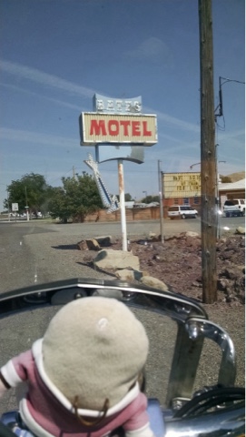
I knew that going into Canada would have it's challenges. First time using my pass port, adjusting to exchange rate, converting Imperial Gallons to U.S. gallons, using the metric system for everything. But I have an advantage now to make sure no one takes advantage of me. I had a nice young man in the lobby of the motel, for only $15.00 U.S., download an app that converts the MBS data rate (MegaBytes per second) of my IPad to MMBS (Metric MegaBytes per second). So now the conversions are automatic! No one can get the best of me!!!
It was only a half hour ride this morning to get to the Canadian Border. That was where traffic backed up and I found myself sitting in a lane of traffic, inching forward each time a car at the head of my lane was flagged through. As is the case in the grocery store, one lane moves, then each lane eventually moves so you end up passing, then catching up with the same people over and over.


 As I went through this I began to wonder about my (air cooled) engine temperature. I made it through rush hour in Miami Beach okay but, when I saw a biker pull his bike over in the south bound lane and shut it off, apparently overheated, I decided to take action. The lines had sorted themselves out to where no one was likely to jump ahead of me if I didn't stay right on the bumpier ahead of me. So I shut my engine off after moving forward, then waited for two vehicles to advance before filling the hole.
As I sat waiting to advance I heard a female voice, turned and saw the lady in the car next to me repeat, "who's Betty?". Obviously she had just read my license plate, 4UBETY.
"My late wife", I replied.
"I figured as much."
I delivered my elevator speech, explaining how Betty was traveling with me, and where we have been. She was moved and said that she hoped I had a nice visit to B.C. When I told her I was wanting to take in the scenery of Vancouver she told me that I needed to drive about 1 1/2 hours up the coast to Whistler. "Then, when you think you've seen it all, take the Sea to Sky Gondola to the top". All of this while we advanced back and forth, right up until she pulled up to the inspection station. A rather unique conversation, aye?
When I pulled forward I fully expected to be asked a number of questions. The young lady looked at me and asked something, but I couldn't hear her, so I shut the engine off and asked her to repeat herself.
"Why aren't you traveling with your spouse?" was her query.
I paused, unsure I had heard her correctly. What happened to am I carrying a weapon, any plants, how long will I be in the country? No, the question was why am I not traveling with my spouse! I thought ever so briefly to tell her I AM traveling with my spouse, but thought better of it.
"She's deceased" was the way it came out.
"I'm sorry, but it's the wedding ring. I needed to ask" she explained as she pointed to the ring I still wear continually.
Because the computer showed I had not been to Canada in over a decade ("over 4 decades" I corrected, although it probably has only been 30 years) they had me pull to the side so they could inspect my bike and run a background check. I was going to ask if my parking ticket from Rome would show up, but thought that might be better left unsaid.
It took awhile but I was finally cleared of all wrong doing (yup, did hard time at customs) and stopped to exchange some money. In the mean time, Canada was busy moving Vancouver further away from the border. I had only 85 miles to cover when I left Burlington this morning. Now the signs told me it was still 70 to go! And it was only 23 degrees too. A cold front moving in from Canada, aye?
The plan was to see if I could find a motel for the night. I had been warned by the information desk lady it would be difficult this time of year. If no room was found I needed to catch the ferry to Victoria on Vancouver Island by 3 p.m. so that I could catch the last ferry from there to Port Angeles, WA, in the Olympic National Park back on the main land.
I found a room, then scooted up the coast to see if I could find Whistler.
The ride up the coast was dramatic but could have been more enjoyable if the engineers had provided a place to periodically pull off for pictures. The problem, no doubt was that they couldn't build a large enough parking lot to avoid a traffic backup on the highway!
I didn't make it to Whistler. Due to some poor planning on my part I was playing with running out of fuel, not being able to convert the kilometers to the next town into miles of range left in the tank. I made it but it was more of a challenge than it should have been. That was also when I figured out the price of gas was for a liter, not the Imperial Gallon that they did away with in 1979.
The Sea to Sky Gondola was incredible. 


I know of several people who would freak out big time from the view. 


In addition there were several other heart stopping views on top, like a viewing deck 


and the Sky Pilot suspension bridge.


I rode up with two locals who were taking there first ride on the gondola which is only 2 years old. They said it was built by the citizens of Squamish who were tired of watching all the traffic whiz by on their way to Whistler, but not stopping to spend tourist dollars.
I went back down earlier than I would have if I had known of this and planned a visit to include one of several hiking possibilities. On my ride back I stopped just south of the Sea to Sky gondola site to observe Shannon Falls. It looked much better in person than it did on "film".


So, I'm here in my metric room, finishing my metric post so I can add metric pictures to the finished file. Tomorrow I'll take a couple pictures of Vancouver, then head for the ferry. I hope to get into Olympic N.P. in time to do a lap, then head inland.
Oh, and I almost forgot this... A bi-lingual sign that Brian Regan would love! Look at the spelling in the Squamish Indian language on top! Perfect, right Brian?


Wednesday, August 10, 2016

Day 88 - Kettle Falls to Burlington, WA.

An incredible ride through the North Cascade mountains

A very pleasant surprise

My route today, as originally laid out, was to be a heavy dose of Highway 2. Since having to cut the north east corner off of Maine I have been going (literally) out of my way to stay closer to the Canadian border. So when I noticed that Highway 2 was taking a serious dip to the south I went searching. That was when The Girls came up with Highway 20, which took me last night to Kettle Falls, WA.
This morning, being unable to get a signal to view my map, I simply stayed on Highway 20 which I had noticed would take me most of the way across the state. The big surprise came this afternoon.

I left Kettle Falls in such a hurry (frustrated that I could not get a Wi-Fi signal that would allow picture up-loads) that I didn't even get my free cup of coffee.
The first 35 miles was a great ride, crossing the headwaters (almost) of the Columbia River, then over Sherman Pass on a scenic byway, bringing me to Republic, WA. It was there that I found a nifty little restaurant inside a gas station! 
The room was the unique thing here. Shaped in a semi-circle, the backdrop was an outdoor scene to the left of a pole that sat in the middle of the wall. That pole was a tree, and high up in the tree was a branch with a bird house resting on it. At the end of the branch was a bird.
and the food was good too!

Continuing west on Highway 20 I passed through a variety of landscapes. Ponderosa Pine gave way to apple orchards, then things leveled out and opened up into range lands.

Eventually the range lands narrowed and funneled into a valley along the Methow River. By the time I hit the end of the canyon I was climbing, and that's where the surprise came into play. 
There's a saying that people don't appreciate anything they don't have to pay for.
I had forgotten that north central Washington had a National Park, the Northern Cascade N.P. No gate, no lodge, no admission. Maybe no one ever told me about this because there's no admission!?! But scenery to die for!
After going up and over Rainy Pass, the road descended a long way down to Diablo Canyon where the green glacier fed lake was stunning.
I mention the long downhill because it turned out to be quite important. I didn't fill up in Republic and found myself calculating how far I could make it based on my (sometimes very inaccurate) range meter. As I entered the park there was only 22 miles of "safety factor" to Newhalen, WA. By the time I descended to Newhalen my margin of safety was up to 50 miles! Good thing too, because there was no gas available in Newhalen. The next station was in Marblemount, 14 miles further downstream.
In that 14 mile stretch I hit a milestone
That represents 16,000 miles on this road trip. By day's end I found myself at Interstate 5, very nearly to the far northwest corner of the U. S.
 I'm spending tomorrow heading northwest, across the 49th Parallel, to Vancouver, British Columbia. Now if I only knew how I was getting back...


Tuesday, August 9, 2016

Day 87 - Kalispell, Mt. to Kettle Falls, WA.

Breezed right through Idaho

A potpourri of weather

I started the day at the gas station, filling up and taking a picture of the clouds to the northwest, where I was headed. I'd like to say I managed to stay dry despite the ominous cloud cover.

I'd like to say that but... it started to rain within 5blocks of the gas station. Because I had put my rain suit on I was able to continue on my way. The rain never developed into a downpour o my advance was cautious but still at about 50 mph. After a half hour the rain ceased and I rode under cloudy, threatening, partly clouded and sunny skies the rest of the day.
The ride west from Kalispell was primarily along Highway 2, headed toward Libby. 
I found a unique restaurant a couple of blocks off the route in the City of Eagles. 

The Libby Cafe (deduct .2 points for creative name) had an eclectic gathering of decorations, stuffed in every corner, right down to a parking meter mounted in the corner of the "L" shaped lunch counter. The food was good but, even better was the menu. I think this is the first time I took pictures of a menu.
Sorry they're sideways. I may be able to rotate them but don't know how


I noticed when I got off the bike that I could not walk normally. My ankles did not want to bend or support me properly, almost as if they were falling asleep. I guess you could say my ankles quit on me.
On the road after lunch I crossed into the Idaho panhandle and soon drew into Bonners Ferry. 

I elected to take another break at the Three Mile Diner, giving my ankles a rest. While sitting inside drinking a Pepsi and munching on a bag of M&Ms (see Lisa, you can still eat well on the road!) a chap walked in. He was dressed in leather and had just hopped off of his BMW touring bike. I talked to him briefly, as I was about finished, then kicked myself later for not sitting and talking further.
He was from the U.K. and was touring the U.S. by motorcycle. He had started in San Fran and cross-crossed the country several times. He intended to ride in all 48 states in 6 months, compiling about 20,000 miles. He had spent the night in Spokane and was still trying to figure out why it was pronounced Spo-can, instead of spo-cain. He too was taking it slow covering only a couple hundred miles a day and he was headed toward Kalispell, where I had started my day. I don't know why we didn't exchange names or email addresses.
My time in Idaho was brief. I took Highway 2/95 south to Sandpoint, then west through Priest Lake on my way into Washington. Along the way I stopped and took a picture that Ron will recognize. 

It was in this area that the two of us ran nearly out of water and lost the trail while hiking the Idaho Centennial Trail, resulting in our having to spend an extra night out in Grizzly bear territory, sleeping on a steep hillside, not knowing where we were or how we were going to locate a trail out of there. I recall specifically that I had my only spare meal that night, a pack of smelly (but delicious) Salmon, while wondering how far away the closest Grizz was! Ah, good times!
Because the route through Idaho required me to go south around Priest Lake, I crossed into Washington at Newport, 

then began looking for a route that would take me closer to the 49th parallel while traveling west also. The Girls did good, apparently learning my tastes. 
I had not been using GPS today until I crossed into Washington. They put me on Higway 20, then had me turn onto a road with a name like Flowerly Lane. It took me up a winding road that climbed until I was riding past a (closed) ski area named 40 degrees North; an area I had never heard of. Because it was heavily travelled in the winter it was in excellent shape, making for a very pleasant ride up and over. 
I came out on Highway U.S. 395. I believe this highway is one and the same with the route past Mt. Whitney in So. Cal/Nevada. From there I went north and west until I found myself in Kettle Falls, WA.
Thinking it was time to stop and seeing I had travelled 280 miles already, I selected the Grandview Motel.
After getting my room I discovered A) I was in the Pacific Time Zone and it was only 4 o'clock, B) their free Wi-Fi was worth exactly what I paid for it C) Riding in the rain does not clean your vehicle. Quite the opposite. I stopped mid-way through cleaning to take a picture. Can you tell where I had already cleaned?